
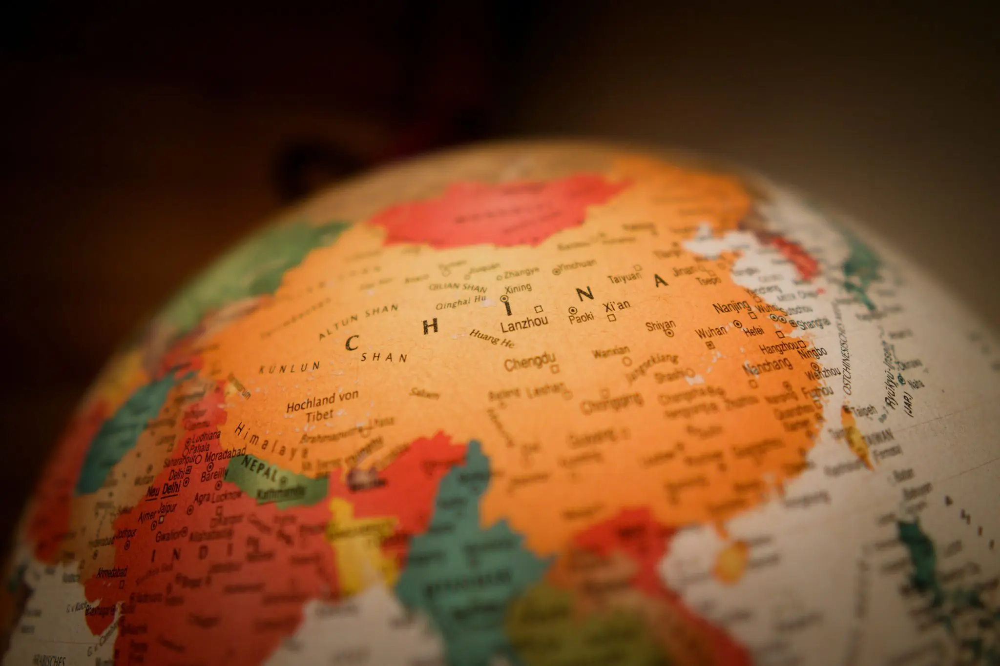
- 中国的中文名称中国(Zhōngguó),字面意思是“中央之国”,中国的地图也反映了这种以自身为中心的世界观。
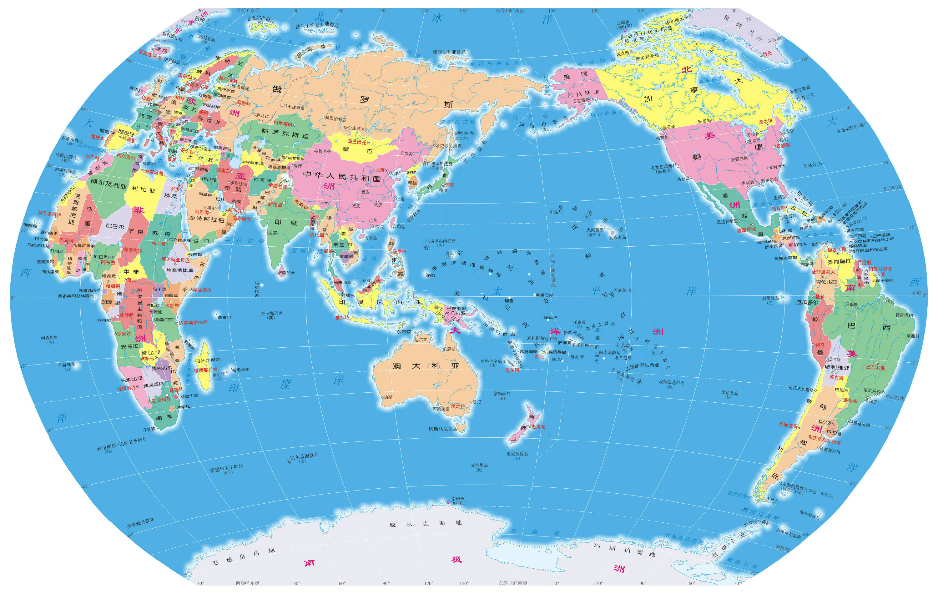
- 中国的世界地图通常把中国放在中央附近,而西方地图往往以欧洲和非洲为中心。
- 现代中国地图包含一些敏感的领土主张,例如南海、钓鱼岛以及中印边境的部分地区。
- Maps made in China use their own GCJ-02 coordinate system, which shifts every point by roughly 100 to 700 meters, so a raw GPS position can look misplaced on them.
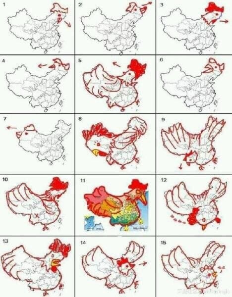
- 人们常说中国的轮廓像一只公鸡,即公鸡(gōngjī)。
答案就在名字里!“中国”一词由两个字组成:中(zhōng),意为中间或中心;国(guó),意为王国或国家。
这两个字合在一起,就是中国:中央之国。中国的地图,乃至中国对自身历史和世界地位的认识,在很大程度上都可以从这两个字中看出来。
01 宇宙的中心
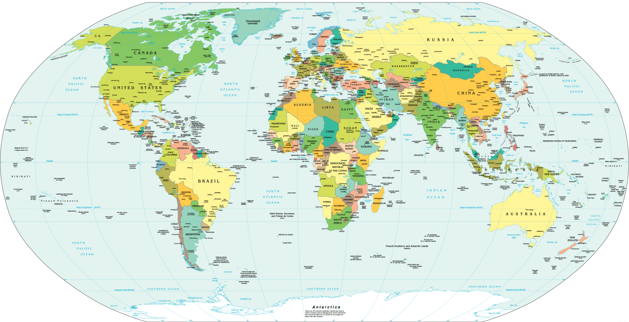
西方课堂上常见的地图被称为“墨卡托投影”。它以欧洲和非洲为世界的中心,亚洲在东边,南北美洲则在西边。
对习惯了这种视角的人来说,第一次看到地道的中国地图,可能会感到十分意外。欧洲被挪到了边缘,而中国则占据了靠近中央的显要位置。
西方与其他地区
经纬度的简单变化背后,隐藏着更深层次的视角调整。自欧洲(随后是美国)确立全球霸权以来,西方国家的居民大多被教导把自己视为世界历史的中心。
这种历史叙述渗透到了方方面面,包括地理,进而影响了制图。在这样的世界观里,西方是独唱者,其余地区不过是伴唱。
历史不会重演,但常常押着相似的韵脚
而中国对历史有着截然不同的理解。中国学校所讲述的历史,着重于数千年来中国走在人类文明前列的漫长岁月。
在那段时期的大部分时间里,西欧只是一个相对无足轻重的半岛。造纸术、火药、指南针、活字印刷术和印刷机,都是人们常常提及的中国悠久的有文字记载的历史的成果。
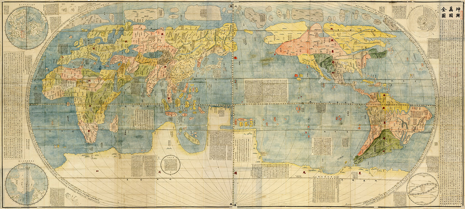
The Kūnyú Wànguó Quántú (坤舆万国全图), the earliest surviving Chinese world map in European style, is an excellent example of this shift in perspective. Drafted in 1602 by Matteo Ricci, a Jesuit missionary, it molds itself to Chinese expectations by showing the Middle Kingdom close to the, well, middle.
简而言之,中国地图反映的是中国的现实。中国之所以被放在靠近中央的位置,是因为在中国版本的历史中,中国本就处于中心附近,这一点和组成国名的汉字如出一辙。
02 喂,看这里!中国的领土敏感问题
中国有过殖民主义的切身经历,也经历过帝制的崩溃,与周边邻国之间还存在诸多边界争端,因此中华人民共和国政府对领土完整问题格外敏感。这种关注也体现在现代中国的地图绘制上。
南海
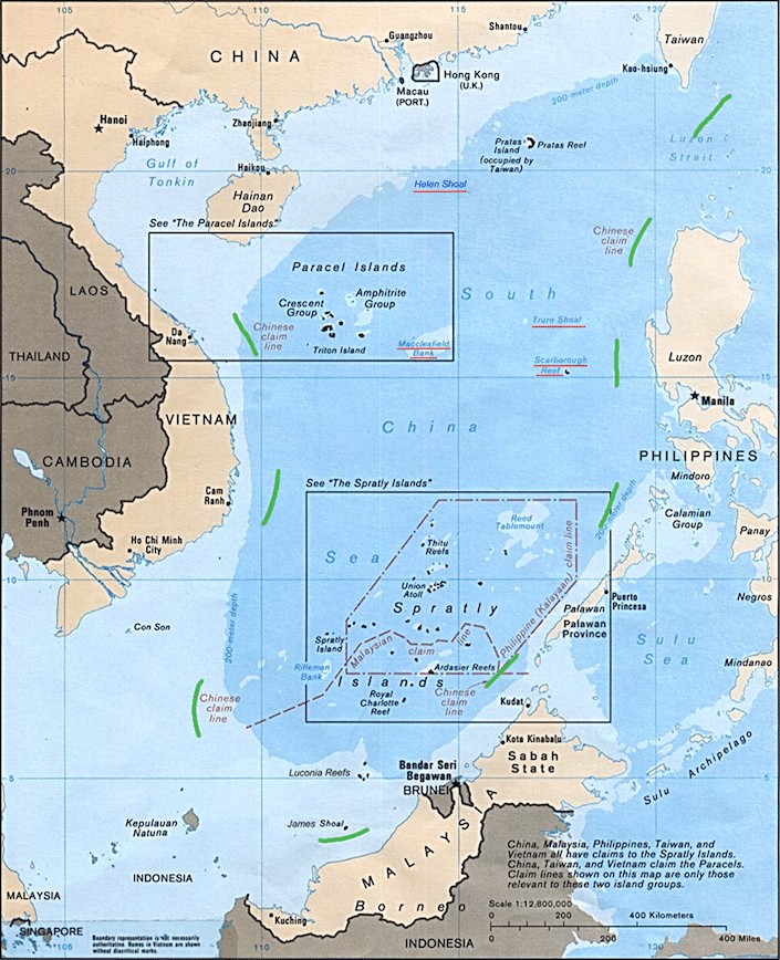
The controversies surrounding who owns what in the South China Sea (南海, Nán Hǎi) have an outsized influence on the appearance of modern Chinese maps. If the map you’re looking at is a made-in-China “real McCoy,” it will undoubtedly include China’s marine claims to the region.
不过,提出主张的并不只有中国。文莱、菲律宾、马来西亚、越南和印度尼西亚等一大批亚洲国家,也在争夺南海的部分海域和岛礁。
China’s territorial claims are marked on its maps with the “ten-dash line,” still widely known as the nine-dash line (九段线, jiǔduàn xiàn). Official maps, such as the 2013 vertical map of China and the 2023 standard map, show ten dashes. Beijing has frequently sent naval vessels to face off against intruders on what it considers its territory.
中国还向海中倾倒了成千上万吨沙子,建造人工岛屿,用于行使自身的主权。不过,为捍卫主张而不惜代价的并非只有中国。
包括菲律宾和越南在内的多个国家,都曾强硬地捍卫自己的领地。在这本就一触即发的局势之上,还有另一个爆炸性因素:该地区海盗组织猖獗,其中一些与当地活跃的反叛团体和恐怖主义网络有关联。
这片土地是我的:钓鱼岛
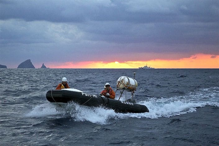
Two other points of geographical contention that help shape modern Chinese world maps are the Senkaku/Diaoyu Islands. Known as the Senkaku Islands in Japan and the Diaoyu Islands (钓鱼岛, Diàoyúdǎo) in China, these uninhabited islands have strained the China-Japan relationship since the early 1970s.
就连这些岛屿的名称都没有基本共识,可见争端之深。人们对日本在第二次世界大战期间所作所为的鲜活记忆,加上 1960 年代发现的海底石油储量,更是为这场地缘政治之火添了一把柴。
日本海上保安厅与中国渔船之间可能致命的高速“猫鼠游戏”日益频繁。因此,现代中国世界地图将钓鱼岛标为中国领土不可分割的一部分。
群山有“声”:中印边境
The mountainous Sino-Indian border is another area where the average Chinese world map may differ substantially from those used elsewhere. The two major points of conflict are centered around 藏南 (Zàngnán), the area India administers as Arunachal Pradesh, and Aksai Chin (阿克赛钦).
In June 2020, this frozen conflict went molten hot for a frightening couple of days. Border patrols fought hand to hand in the Galwan Valley, a disputed corner of the Himalayas. India announced that 20 of its soldiers died, and in February 2021 China acknowledged four deaths on its side.
谷歌地图、《国家地理》以及许多其他国际地图制作机构选择折中处理,用“虚线”标示这两个争议地区。当然,中国制作的地图则将这两处标为由中国控制、不存在争议的地区。

03 中国神话中的四方
“East or West, home is best,” goes the old saying, but in China each direction also has a story attached. The east, for example, belongs to the Azure Dragon and stands for the start of a new day.
In ancient China, each direction was also tied to a part of the sky and to one of the elements, so it said something about where people stood in nature and the cosmos.
这种象征性思维至今仍体现在中国文化的其他方面,从建筑的朝向到风水的原则。四个方位各由一只神兽守护,每只神兽都对应一个季节和五行之一。
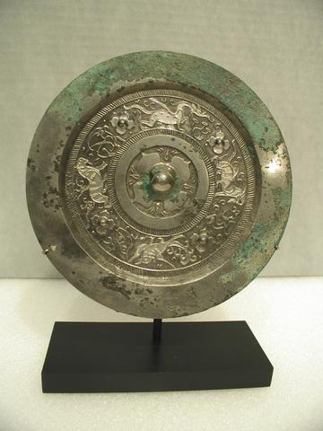
| 中文 | 拼音 | 含义 | 方位 | 五行 | 季节 |
|---|---|---|---|---|---|
| 青龙 | 青龙 | 东 | 木(木) | 春 | |
| 朱雀 | 朱雀 | 南 | 火(火) | 夏季 | |
| 白虎 | 白虎 | 西 | 金(金) | 秋 | |
| 玄武 | 玄武 | 北 | 水(水) | 冬 |
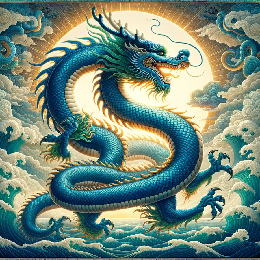
东方:青龙(青龙,Qīng Lóng)
在东方,我们会遇到春季的守护神青龙。这种神话生物是最著名的中国龙之一,象征着新生和成长。
The sun rises in the east, so the east stands for beginnings. It is associated with the wood element (木, mù), the element of spring and new growth.
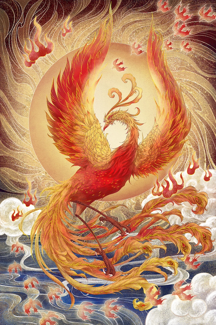
南方:朱雀(朱雀,Zhū Què)
再看南方,朱雀,也就是凤凰,展开了火焰般的双翼。这一夏季的象征代表着蜕变与重生。
In most of China the midday sun sits in the southern sky, so the south is linked to summer heat and to the fire element (火, huǒ), which stands for energy and passion.
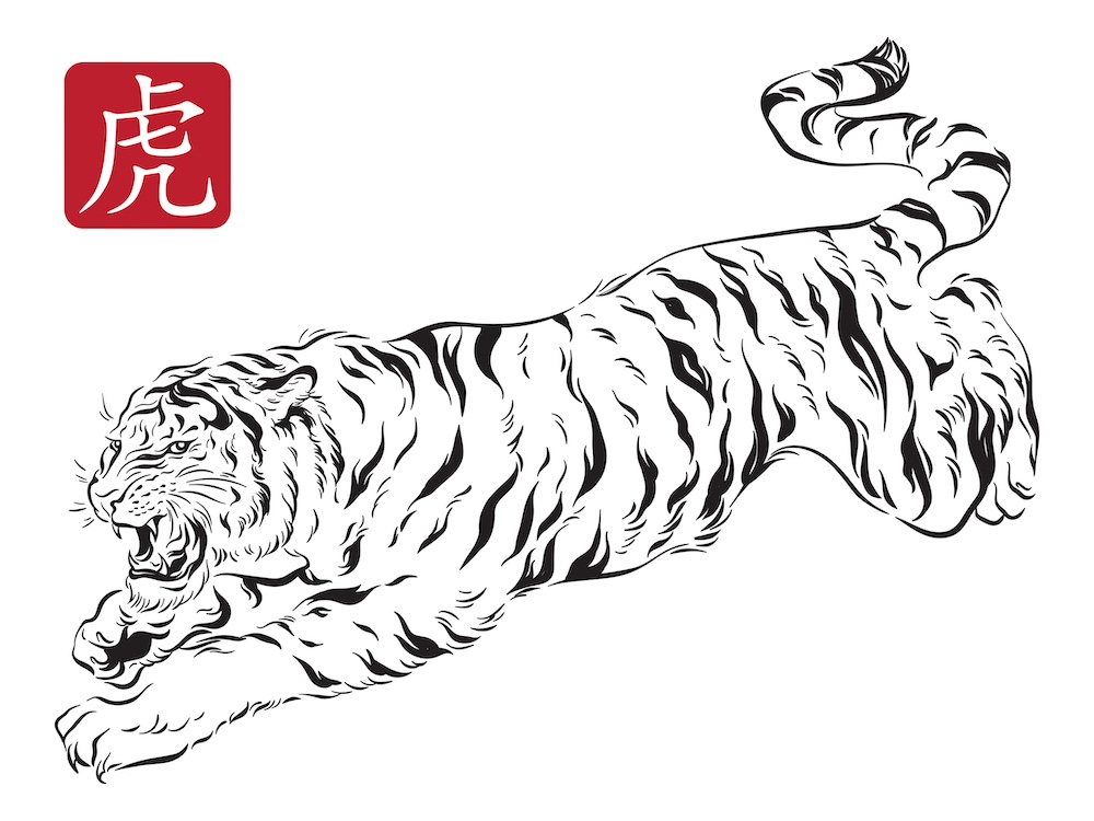
西方:白虎(白虎,Bái Hǔ)
转向西方,秋季的守护神白虎以威严的姿态迎接我们。这头强大的神兽代表勇气与庇佑,在日落夜临之际守护着众灵。
西方与五行中的金相对应(金,jīn),象征着力量、韧性和坚定不移的决心。
北方:玄武(玄武,Xuán Wǔ)
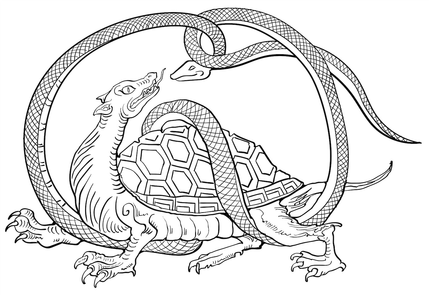
最后,北方是玄武的领地,它常被描绘为一条蛇缠绕着一只龟。作为冬季的象征,玄武代表智慧、长寿和稳定。
北方对应水元素(水,shuǐ),表示适应性、深度和内省的人生本质。
04 地图上的“X”未必准确
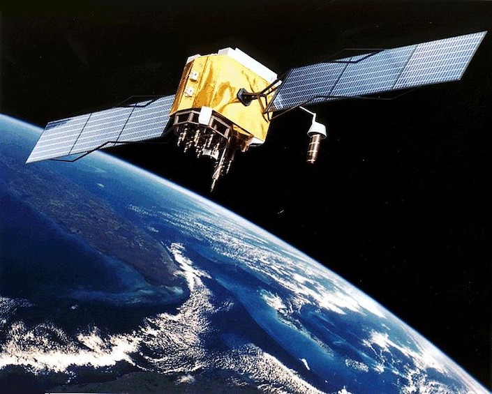
了解中国地图状况时,最后需要考虑的因素之一是GPS的精度。在使用谷歌地图等基于GPS的应用程序浏览中国地图时,请注意:其精度可能不如你预期。
这是我的地盘!
Under the Surveying and Mapping Law of the People’s Republic of China, first passed in 1992 and revised in 2002 and 2017, foreigners and unregistered groups may not survey or map in China without approval. Since the 2017 revision, a foreign person or organization that breaks this rule can be fined up to 1 million yuan (around $140,000 USD).
根据该法,这些数据采集规定旨在确保所采集的位置数据不会“涉及国家秘密或危害国家安全”。这些高得惊人的罚款以人民币计价,人民币是中国的法定货币。
Nor is this an idle legal threat. In 2009, the PRC government fined a group of UK geology students working in China for “illegal map-making,” and in 2013, mapping authorities in Yunnan province accused Coca-Cola of having “illegally collected classified information with handheld GPS equipment.”
进入矩阵:WGS-84 与 GCJ-02
The strings of letters and numbers above are two coordinate systems, the grids that turn a place into latitude and longitude. GPS and most of the world use WGS-84, while maps published in China use GCJ-02.
Your phone’s GPS fix is just as accurate in China as anywhere else. The difference is in the map: before a map of China is published, its coordinates are run through an official formula that deliberately shifts them.
The shift changes from place to place, so you can’t fix it by sliding the whole map over. Put a raw GPS position on a GCJ-02 map (or the reverse) and it lands roughly 100 to 700 meters from where it should be, which is why apps have to convert between the two systems.
嗨,我是你的优步司机
The mapping law and the shifted coordinate system have made Chinese maps hard to line up with GPS data from elsewhere. They have also caused challenges for ride-hailing and bike-sharing apps that rely on accurate coordinates.
The freely available, crowd-sourced coordinate data used by many smartphone applications sits offset on Chinese maps. Only map-making organizations registered with the Chinese government hold the official conversion and may publish maps, so foreign firms must collaborate with one of these organizations to get their apps off the ground.

05 那是一只公鸡吗?
感谢你一路陪伴我们走到这段奇妙的地图之旅的终点,这里还有一个额外的地图知识:人们常说中国的轮廓形状像一只公鸡(公鸡,gōngjī)。
尽管这乍听之下可能令人惊讶,但对于了解内情的中国公民和中国观察人士来说,这早已是常识。公鸡作为国家象征十分贴切,而鸡年至今仍是中国十二生肖中最广为人知的生肖之一,这也绝非巧合。
看看中国地图,你很快就会发现两者的相似之处。不过,共识也就到此为止了:公鸡的头究竟在哪里,至今仍有争论。
06 中文地图词汇
无论你是在看新闻,还是和朋友聊天,下面这些词都能帮你用中文谈论地图、方位和领土。
| 中文 | 拼音 | 含义 |
|---|---|---|
| 中国 | 中国;字面意思是“中央之国” | |
| 地图 | 地图 | |
| 世界地图 | 世界地图 | |
| 南海 | 南海 | |
| 九段线 | Nine-dash line (now drawn with ten dashes) | |
| 钓鱼岛 | 钓鱼岛 | |
| 边界 | 边境;边界 | |
| 公鸡 | 鸡 | |
| 东 | 东 | |
| 南 | 南 | |
| 西 | 西 | |
| 北 | 北 |
07 常见问题
为什么中国的世界地图把中国放在中心位置?
这个国家的中文名称中国(Zhōngguó)意为“中央之国”。中国绘制的世界地图体现了这种世界观,把中国放在中心附近,就像西方地图往往以欧洲和非洲为中心一样。
What is the ten-dash line (nine-dash line)?
The ten-dash line, long known as the nine-dash line (九段线, jiǔduàn xiàn), is the boundary used on Chinese maps to mark China’s claims in the South China Sea. Official Chinese maps have shown ten dashes for decades; the 2013 vertical map and the 2023 standard map brought it wide attention. These claims are contested by several other countries in the region.
为什么GPS在中国有时会不准确?
Your phone’s GPS works normally in China, but maps made in China use their own GCJ-02 coordinate system, which shifts every point by roughly 100 to 700 meters. An app that puts a raw GPS position (WGS-84) on a Chinese map without converting it shows you in the wrong place.
中国的版图真的像一只公鸡吗?
许多中国人都这么说。中国的国土轮廓通常被描述为像一只公鸡(公鸡,gōngjī),但人们对头部究竟由哪一部分构成存在分歧。
08 欢迎来到中国!
A Chinese map shows the world from the middle outward, and its borders and dashes tell you where China’s claims stand today. Reading one well takes a bit of history and a bit of Chinese.
与其只是读一读关于中国地图的文字,何不亲自来中国“迷路”一番?理解这些视角的最佳方式,就是在中国学中文,亲身体验当地文化。
在喜爱中文(CLI)学习,是一次千载难逢的机会,让你沉浸在文化、地图和语言之中。别担心,我们会为你提供准确的路线指引,帮你轻松找到CLI 中心。我们期待在桂林与你相见!