
- The Chinese name for China, 中国 (Zhōngguó), literally means “Middle Kingdom,” and Chinese maps reflect this central worldview.
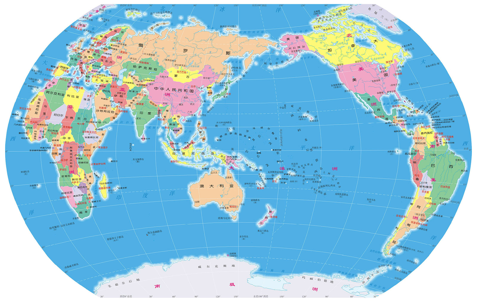
- Chinese world maps typically place China near the center, while Western maps often center on Europe and Africa.
- Modern Chinese maps include sensitive territorial claims such as the South China Sea, the Senkaku/Diaoyu Islands, and parts of the Sino-Indian border.
- China uses its own GCJ-02 coordinate system, which intentionally offsets satellite data, making foreign GPS less accurate inside the country.
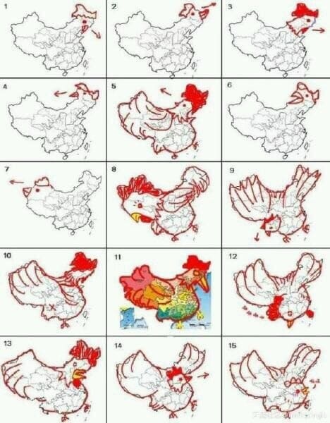
- The outline of China is often said to resemble a rooster, 公鸡 (gōngjī).
It’s in the name! The Chinese word for China fuses two characters, 中 (zhōng), meaning middle or central, and 国 (guó), meaning kingdom or country.
Together, these characters form 中国: Middle Kingdom. China’s maps, and arguably much of its sense of its own history and place in the world, can be deduced from these two characters.
01 The center of the universe
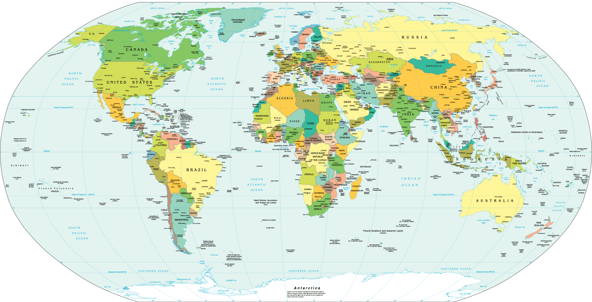
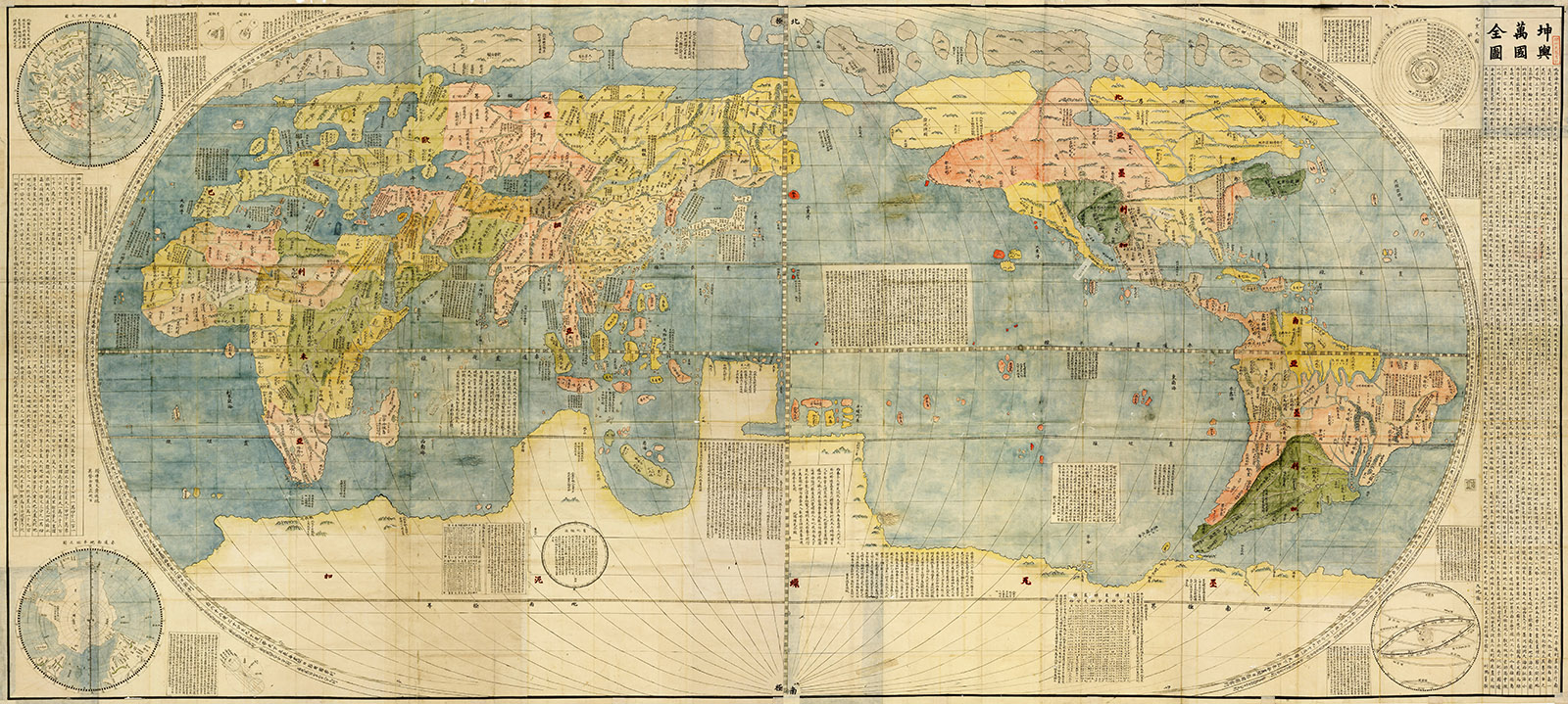
The map common in classrooms throughout the West is known as the “Mercator projection.” It centers the world on Europe and Africa, with Asia off to the east and North and South America over on the west.
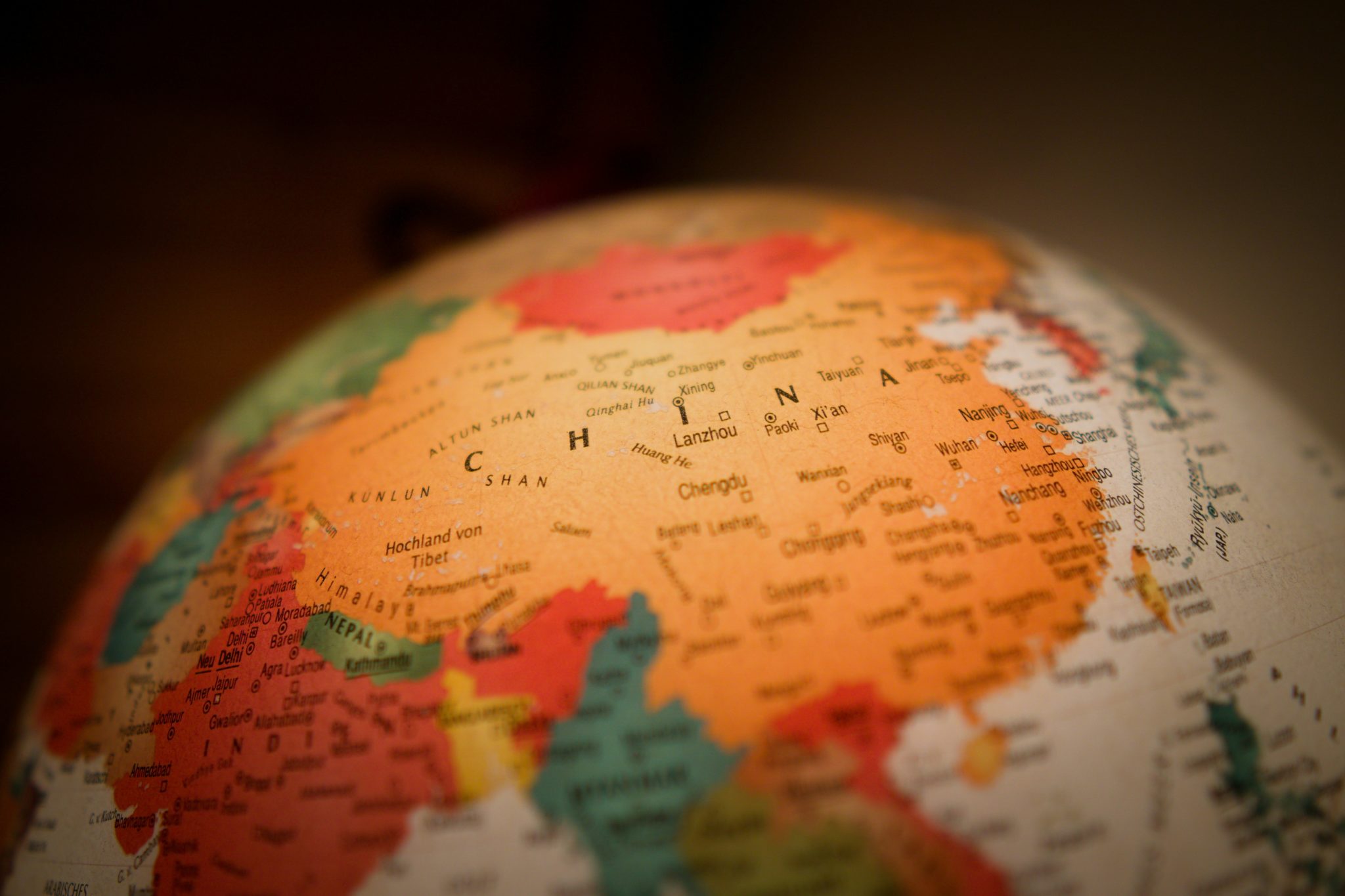
To those accustomed to this perspective, the experience of first encountering an authentically Chinese map can be jarring. Europe has been shifted to the margins, while China now commands the privileged spot close to the center.
The West and the rest
Beneath this simple shift of longitude and latitude lies a deeper adjustment in perspective. Since the dawn of European, and subsequently American, global hegemony, inhabitants of Western countries have largely been taught to see themselves at the center of world history.
This version of history permeated everything, including geography and, subsequently, cartography. In this vision of the world the West is the soloist, while the rest are just backup singers.
History doesn't repeat itself, but it often rhymes
China, on the other hand, has a very different understanding of history. The version told in Chinese schools focuses on the many thousands of years during which China was at the civilizational forefront of humankind’s journey.
During much of that time, Western Europe was a relatively unimportant peninsular outcropping. Paper, gunpowder, the compass, movable type, and the printing press are some of the oft-repeated fruits of China’s long recorded history.
The Kūnyú Wànguó Quántú (坤舆万国全图), the earliest known Chinese world map printed in European style, is an excellent example of this shift in perspective. Drafted in 1602 by Matteo Ricci, a Jesuit missionary, it molds itself to Chinese expectations by showing the Middle Kingdom close to the, well, middle.
In short, the Chinese map reflects the Chinese reality. China is placed near the center because, much like the characters that compose the country’s name, China sits near the center of China’s version of history.
02 Ahoy there! China's territorial sensitivities
China’s intimate experience with colonialism, imperial collapse, and numerous border disputes with its neighbors have made the government of the People’s Republic of China (PRC) quite sensitive to matters of territorial integrity. This focus transfers over to modern Chinese cartography.
South China Sea
The controversies surrounding who owns what in the South China Sea (南中国海, Nán Zhōngguó Hǎi) have an outsized influence on the appearance of modern Chinese maps. If the map you’re looking at is a made-in-China “real McCoy,” it will undoubtedly include China’s marine claims to the region.
However, China is not alone in its claims. It is joined by a whole gaggle of other Asian countries, including Brunei, the Philippines, Malaysia, Vietnam, and Indonesia, in contesting bits and pieces of the South China Sea.
China’s territorial claims are usually indicated on maps using what is called the “nine-dash line” (九段线, jiǔduàn xiàn). Beijing has frequently sent naval vessels to face off against intruders on what it considers its territory.
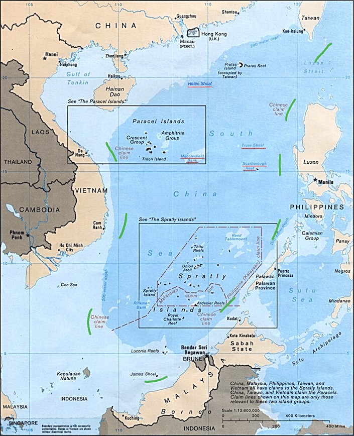
China has also poured thousands of tons of sand into the ocean to create artificial islands for its own sovereign purposes. It isn’t the only country willing to go to great lengths to defend its claims, however.
Various countries, including the Philippines and Vietnam, have been known to aggressively defend their turf. On top of this already-flammable situation one can add another explosive element: the region is rife with pirate organizations, some connected to rebel groups and terrorist networks active in the area.
This land is my land: the Senkaku/Diaoyu Islands
Two other points of geographical contention that help shape modern Chinese world maps are the Senkaku/Diaoyu Islands. Known as the Senkaku Islands in Japan and the Diaoyu Islands (钓鱼岛, Diàoyúdǎo) in China, these uninhabited islands have strained the China-Japan relationship for more than a hundred years.
The fact that there is not even a basic agreement about the name hints at how deep the struggle goes. Vivid memories of Japan’s actions during the Second World War, along with the discovery of undersea oil reserves in the 1960s, have only oxygenated this geopolitical fire.
A potentially lethal, high-speed game of “cat-and-mouse” between the Japanese coast guard and Chinese fishing vessels has become increasingly common. Consequently, modern Chinese world maps include the Senkaku/Diaoyu Islands as part of China’s integral territory.

The hills are alive: the Sino-Indian border
The mountainous Sino-Indian border is another area where the average Chinese world map may differ substantially from those used elsewhere. The two major points of conflict are centered around Arunachal Pradesh (阿鲁纳恰尔邦) and Aksai Chin (阿克赛钦).
In June 2020, this frozen conflict went molten hot for a frightening couple of days. An undisclosed number of Chinese and Indian soldiers were killed and injured in hand-to-hand brawls as border patrols clashed in a disputed corner of the Himalayas.
Google Maps, along with National Geographic and many other international mapmaking organizations, have opted to split the difference by extending “dashed lines” across both contested territories. Naturally, maps produced in China show unchallenged Chinese control.

Learn Chinese with Cultural Context
CLI offers personalized Chinese instruction built around real language and culture. Join our Immersion Program in Guilin or start online with a free Chinese lesson.
03 Cardinal directions in Chinese mythology
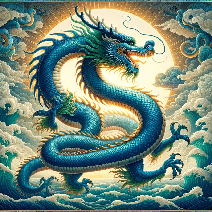
“East or West, home is best,” goes the old saying, but in China every direction tells a story as intricate as a finely woven silk tapestry. Picture the majestic Azure Dragon soaring high in the eastern sky, symbolizing the beginning of a new day.
In ancient China, cardinal directions weren’t mere navigational tools. They were a language, a way to communicate with the heavens and the elements, each direction holding a key to the relationship between humans, nature, and the cosmos.
This symbolic thinking still echoes through other parts of Chinese culture, from the orientation of buildings to the principles of feng shui. The four directions are each guarded by a celestial animal tied to a season and one of the Five Elements.
| Chinese | Pinyin | Meaning | Direction | Element | Season |
|---|---|---|---|---|---|
| 青龙 | Azure Dragon | East | Wood (木) | Spring | |
| 朱雀 | Vermilion Bird | South | Fire (火) | Summer | |
| 白虎 | White Tiger | West | Metal (金) | Autumn | |
| 玄武 | Black Tortoise | North | Water (水) | Winter |
East: the Azure Dragon (青龙, Qīng Lóng)
In the east we encounter the Azure Dragon, the guardian of the spring season. This mythical creature, one of the best known of all Chinese dragons, symbolizes renewal and growth.
As the sun rises in the east, it brings the promise of a new day, embodying hope and endless possibilities. The east is associated with the wood element (木, mù), symbolizing strength, flexibility, and the upward surge of life.
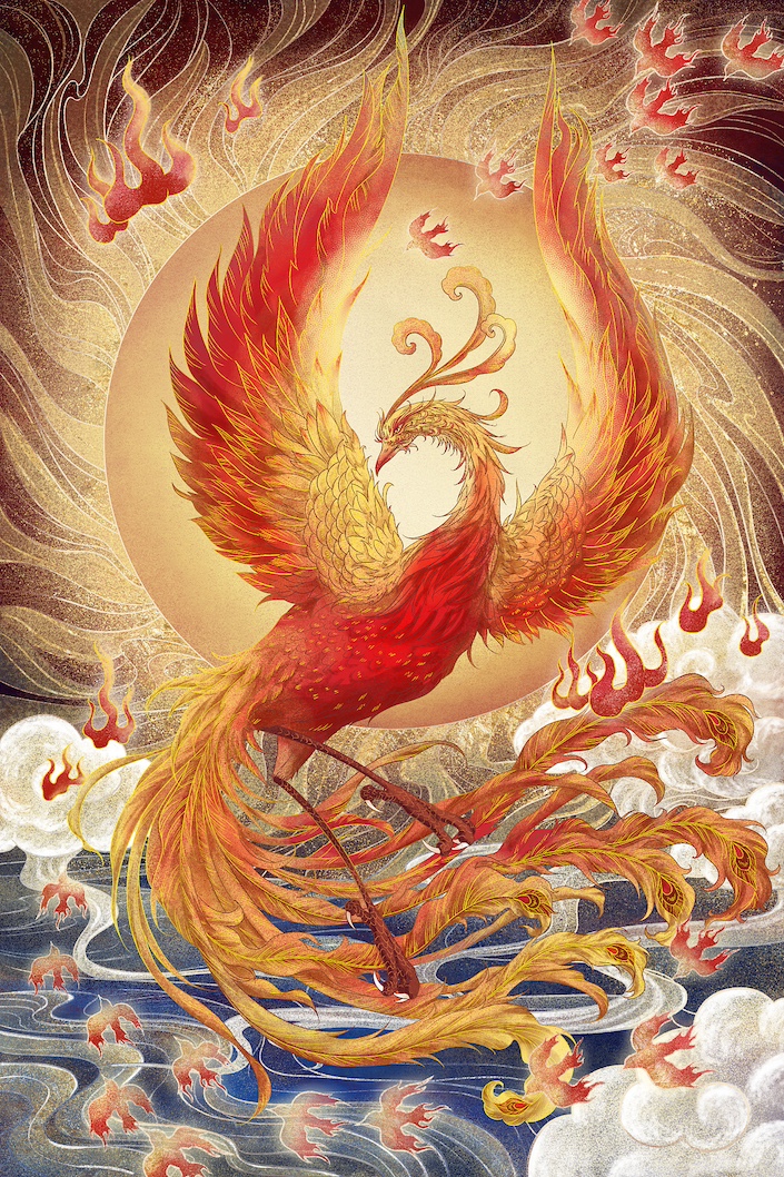
South: the Vermilion Bird (朱雀, Zhū Què)
Turning to the south, the Vermilion Bird, or Phoenix, spreads its fiery wings. This emblem of the summer season represents transformation and rebirth.
In the scorching heat of the south, life undergoes trials by fire, emerging stronger and more resilient. The south is tied to the fire element (火, huǒ), reflecting passion, energy, and the dynamic nature of existence.
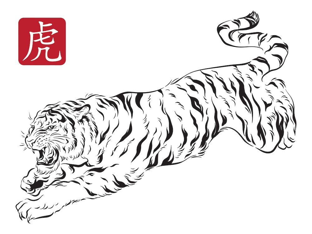
West: the White Tiger (白虎, Bái Hǔ)
As we pivot to the west, the White Tiger, guardian of the autumn season, greets us with its majestic stance. This powerful beast stands for courage and protection, guarding the spirits as the day gives way to night.
The west is associated with the metal element (金, jīn), indicative of strength, resilience, and unyielding determination.
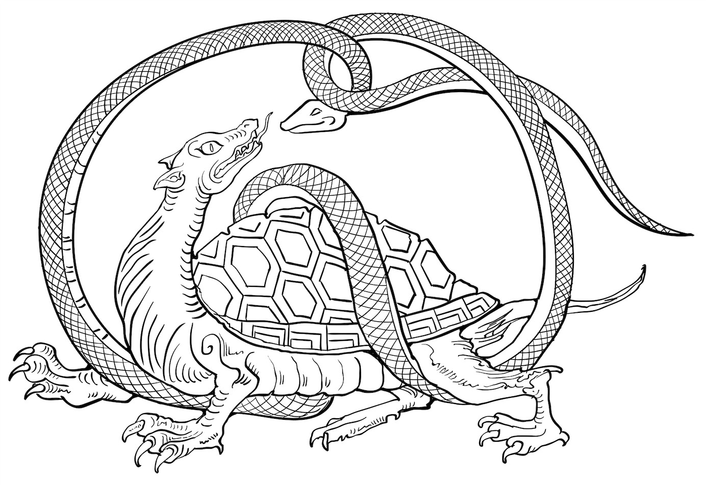
North: the Black Tortoise (玄武, Xuán Wǔ)
Finally, in the north lies the realm of the Black Tortoise, often depicted with a snake coiling around it. This symbol of the winter season represents wisdom, longevity, and stability.
The north corresponds to the water element (水, shuǐ), denoting adaptability, depth, and the introspective nature of life.
04 X doesn't really mark the spot
One of the last features to consider when getting a handle on the Chinese cartographic situation is the accuracy, or inaccuracy, of GPS. When browsing a map of China on GPS-powered applications like Google Maps, be forewarned: it might not be as precise as you’d hope.
Get off my lawn!
Since the passage in 2002 of the Surveying and Mapping Law of the People’s Republic of China, it has been illegal for foreigners, as well as any unregistered entity, to privately gather GPS data in China. Individuals or groups who break the law could be fined up to 1 million yuan (around $150,000 USD).
According to the law, these data collection regulations are an attempt to ensure that the location data gathered does not “touch upon state secrets or endanger state security.” Those eye-watering fines are quoted in the Chinese yuan (renminbi), China’s official currency.
Nor is this an idle legal threat. In 2009, the PRC government charged a group of UK geology graduate students working in China with “illegal map-making,” and in 2014, Coca-Cola was formally charged with having “illegally collected classified information with handheld GPS equipment” in Yunnan province.
Enter the matrix: WGS-84 vs. GCJ-02
The strings of letters and numbers above are the two ways the world processes location data relayed by orbiting satellites. China uses GCJ-02, while most of the rest of the world uses WGS-84.
The uniquely Chinese way of communicating coordinate data to and from satellites is fundamentally different. Before reaching your phone, Chinese coordinates are first fed through an algorithm that purposefully fudges the distances between spots, slightly diminishing their accuracy.
All locations on the map are tugged slightly in random directions, which makes exact coordinates impossible to pin down. Although the offset is only plus-or-minus one meter per point, the locations are pulled in different directions, collectively resulting in a lot of distortion.
Hi, this is your Uber driver
The cybersecurity laws and the unique satellite-relaying system have affected the accuracy of Chinese maps. They have also caused challenges for ride-hailing and bike-sharing apps that rely on accurate coordinates.
The freely available, crowd-sourced coordinate data used by many smartphone applications simply doesn’t work in the PRC. Only map-making organizations registered with the Chinese government have access to accurate data, so foreign firms must collaborate with one of these organizations to get their apps off the ground.

05 Is that a rooster I see?
For sticking with us to the end of this wild cartographic journey, here’s a bonus map fact: China’s outline is often said to be shaped like a rooster (公鸡, gōngjī).
Despite the surprise this may at first elicit, it’s common knowledge among in-the-know Chinese citizens and China watchers. The bird is a fitting national symbol, and it’s no coincidence that the Year of the Rooster remains one of the most recognizable signs in the Chinese zodiac.
Take a gander at a map of the country and you’ll quickly see the resemblance. However, that’s where the agreement stops, because exactly where the head is, now that is up for debate.
06 Chinese map vocabulary
The following terms will help you talk about maps, directions, and territory in Chinese, whether you’re reading the news or chatting with friends.
| Chinese | Pinyin | Meaning |
|---|---|---|
| 中国 | China; literally “Middle Kingdom” | |
| 地图 | Map | |
| 世界地图 | World map | |
| 南中国海 | South China Sea | |
| 九段线 | Nine-dash line | |
| 钓鱼岛 | Diaoyu (Senkaku) Islands | |
| 边界 | Border; boundary | |
| 公鸡 | Rooster | |
| 东 | East | |
| 南 | South | |
| 西 | West | |
| 北 | North |
07 FAQ
Why is China placed in the center of Chinese world maps?
The Chinese name for the country, 中国 (Zhōngguó), means “Middle Kingdom.” Chinese maps reflect this worldview by placing China near the center, much as Western maps tend to center on Europe and Africa.
What is the nine-dash line?
The nine-dash line (九段线, jiǔduàn xiàn) is the boundary used on Chinese maps to mark China’s claims in the South China Sea. These claims are contested by several other countries in the region.
Why is GPS sometimes inaccurate in China?
China uses its own GCJ-02 coordinate system, which runs satellite data through an algorithm that intentionally offsets locations. This makes foreign, WGS-84-based GPS apps less accurate inside the country.
Is China really shaped like a rooster?
Many people in China say so. The country’s outline is commonly described as resembling a rooster (公鸡, gōngjī), though people disagree about exactly which part forms the head.
08 Welcome to China!
A Chinese map is more than a set of borders. It carries history, identity, mythology, and a distinct way of seeing the world from the center outward.
Instead of just reading about the maps of China, why not come and get lost in person? The best way to understand these perspectives is to Learn Chinese in China and experience the culture firsthand.
An educational stay at CLI offers a once-in-a-lifetime chance to enjoy cultural, cartographic, and linguistic immersion. And don’t worry, we’ll provide you with accurate directions to help you find the CLI Center with ease. We look forward to welcoming you to Guilin!